Hello, welcome to Nanjing Longce surveying and Mapping Technology Co., Ltd!
语言选择:  ∷
∷ 
∷ ∷ 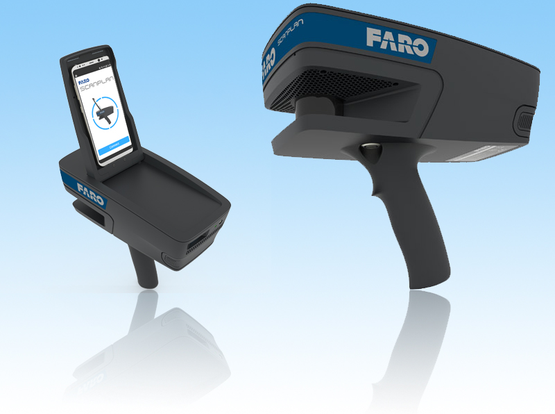
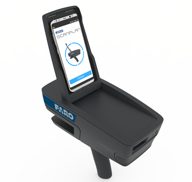
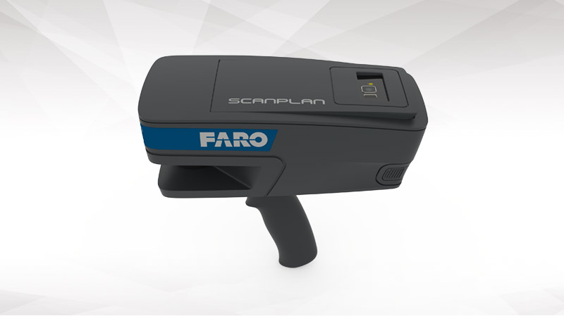


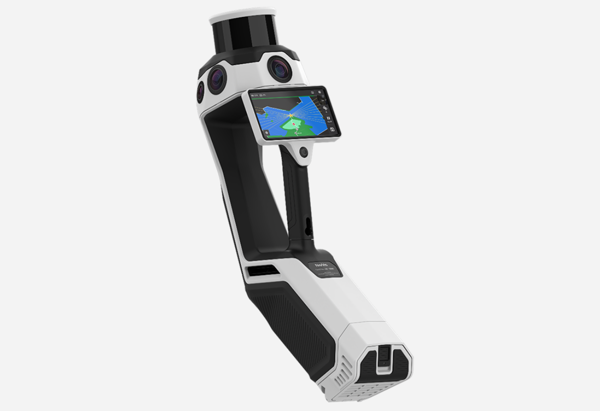
Capture 2D Floorplans In Seconds
Easily capture building floor plans and photographs of critical details walking through a site. Turn those floor plans into comprehensive, pre-incident plans with FARO Zone 2D software.
Portable and Lightweight
At only 1.5 kg (3.3 lb), the ScanPlan is easily carried in one hand.
Easy to Use
Use the familiar interface of a smart phone app to control the ScanPlan and save projects.
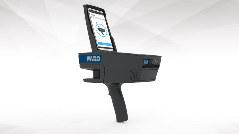
Visualize the Floor Plan
View the floor plan as it is being scanned so you can be confident the entire building is documented when you leave.
Further Document With Photographs
Add photographs and annotations directly to the floor plan to document all the details of the scene.
Capture Floorplans on Multiple Floors
Capture floor plans on multiple stories and organize them into one project.
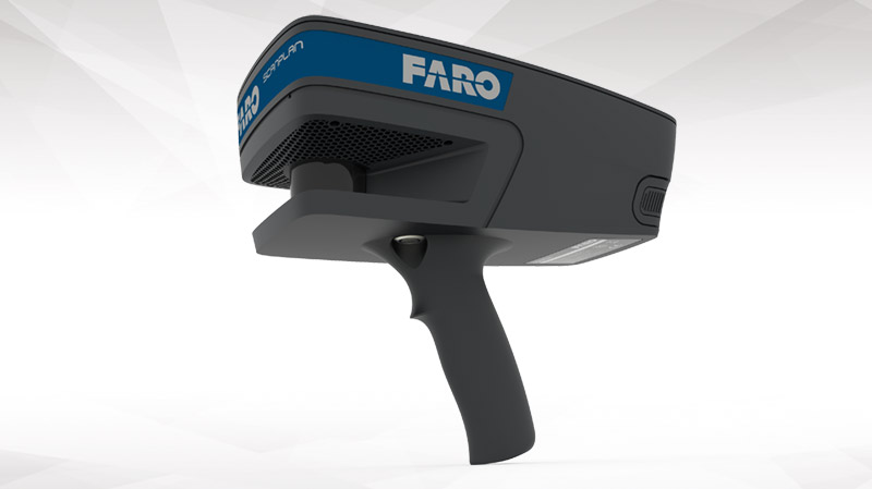
Extended Scanning Time
Scan for two hours one battery; easily swap in a new, charged battery and keep scanning.
Compatible With Most Smart Phones
Use your own Android or iPhone that meet ScanPlan requirements or purchase a compatible smartphone separately.
Share Completed Projects
Share 2D floor plans with stakeholders via SCENE 2go or by directly uploading them into SCENE WebShare Cloud. Optionally, in FARO Zone completed plans can be also shared via the FARO Zone Viewer application.
Easily Export and Share
Easily export projects, images and documents as DXF, PDF or into a ESRI Shape file for use in GIS systems, export the 2D map as a point cloud into CPE, PLY and XYZ.
Find Best Positions to Place a Laser Scanner
Scan Assist feature automatically calculates the best laser scanner positions based on the recorded 2D map.
Perform a Pre-Placement of 3D Scans on Site
Combine the ScanPlan with laser scans and get confidence that a final scan registration will work. ScanPlan allows the pre-placement of single scans1.
1 Supported: FARO® FOCUSS and FOCUSM scanners with firmware version 6.4 or higher
Add 360° Panoramic Images to the 2D Map
Experience the captured space by visually walking through the panoramic images.
Explore Captured Space in Virtual Reality Mode
Easily export the project and the panoramic images directly into present4D VR Suite for best user experience.
Additional Diagramming Software
Bring ScanPlan floor plans into FARO Zone software to complete the diagram by adding doors, windows, stairs, alarm panels, sprinklers, utility shut-offs, dimensions, and more. FARO Zone 2D is included.
Finished Diagrams, Fast
Generate walls automatically, use pre-drawn symbols and smart tools in FARO Zone software to quickly and easily complete your diagrams.
Threat Assessments– Capture accurate building plans to help determine the credibility and seriousness of threats as related to a particular physical location
Pre-incident planning – Give first responders the information they need to make the critical decisions that will reduce loss of life and property damage when called to a fire or other incident
Protective Advances – Gather all the measurements and photographs needed to thoroughly document a site and create an effective protection plan
High Profile Events Create detailed pre-incident and security plans that include accurate dimensions, egress plans, security camera locations and photographs of an entire site
Arson & Explosion Investigation – Quickly document and preserve building evidence in post-fire scenes, even in complete darkness, reducing the investigator’s exposure to hazardous chemicals
Crime Scene Investigation & Reconstruction – Capture and preserve demonstrative evidence at crime scenes, such as the complete floor plan of a building where a crime occurred.
2D As-Built Documentation – Document construction sites and buildings by capturing 2D floor plans that can be used for project evaluation, conceptual design, facility and property management activities as well as exposé creation and presentation
Scan Job Planning – Quickly document site conditions and receive immediate information about the size of a scan job, the number of needed laser scans, and ideal scan positions. Information that can be used for more efficient effort estimation and quotation
 Sweep WeChat yards pay attention to us

Quotation and presentation requestliuchunlei@longce.net

The mobile phone+86 13851969931
Nanjing Longce Measurement Technology Co., Ltd Address:No.15 Xinghuo Road, Jiangbei new district, Nanjing,China. ICP:苏ICP备20044645号-1